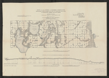
Detail View: Touchton Map Library: Survey for the opening of steamboat communication from Saint John's River, Fla., by way of Tohopokeliga Lake, to Charlotte Harbor or Peace Creek. Eastern section, from Lake Winder to Tohopokeliga Lake.
|
Accession Number:
|
L2018.105.023
|
|
M Number:
|
M1272
|
|
Short Title:
|
Survey for the opening of steamboat communication from Saint John's River, Fla., by way of Tohopokeliga Lake, to Charlotte Harbor or Peace Creek. Eastern section, from Lake Winder to Tohopokeliga Lake.
|
|
Year:
|
1882
|
|
Author:
|
W.G. Williamson
|
|
Author:
|
J.F. Le Baron
|
|
Author:
|
J. Gartland
|
|
Author:
|
R. Paulson
|
|
Institution:
|
U.S. Army. Corps of Engineers
|
|
Object Publisher:
|
Government Printing Office?
|
|
Place of Publication:
|
Washington, D.C.
|
|
Obj Height cm:
|
15
|
|
Object Width cm:
|
48
|
|
Scale:
|
ca. 1:134,640
|
|
Continent:
|
North America
|
|
Country:
|
United States
|
|
State:
|
Florida
|
|
Geographic Area:
|
Saint Johns River
|
|
Language:
|
English
|
|
Cartobibliographic notes:
|
Map includes: Longitudinal section on line surveyed from Tohopokeliga Lake to Lake Winder. Horizontal scale [ca. 1:134,460]. Vertical scale [ca. 1:760].
"Sent to the Chief of Engineers, with my report dated May 23rd, 1882." [Signed] Q.A. Gillmore.
"Sen. ex. doc. no. 189, 1st sess., 47th cong."
|
|
Subject Information:
|
Canals
|
|
Subject Information:
|
Saint Johns River (Fla.)
|
|
OCLC:
|
39551957
|