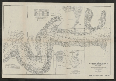
Detail View: Touchton Map Library: Survey of St. Marys River, Ga & Fla : in two sheets. Sheet No. 1, August 27 & 28, 1914.
|
Accession Number:
|
L2018.098.048
|
|
M Number:
|
M1398
|
|
Short Title:
|
Survey of St. Marys River, Ga & Fla : in two sheets. Sheet No. 1, August 27 & 28, 1914.
|
|
Year:
|
1915
|
|
Author:
|
W.C. Lemen
|
|
Author:
|
M.V. Haas
|
|
Contributor(s):
|
W.C. Langfitt
|
|
Object Publisher:
|
U.S. Army Corps of Engineers, Savannah District
|
|
Place of Publication:
|
Savannah, Ga.
|
|
Obj Height cm:
|
41
|
|
Object Width cm:
|
64
|
|
Scale:
|
ca. 1:9000
|
|
Continent:
|
North America
|
|
Country:
|
United States
|
|
State:
|
Florida
|
|
State:
|
Georgia
|
|
Geographic Area:
|
Saint Marys River
|
|
Language:
|
English
|
|
Cartobibliographic notes:
|
"Made under the direction of Colonel W.C. Langfitt, Corps of Engineers, U.S. Army."
Includes tables for station coordinates and bench marks, index map, and street map of downtown St Marys, Georgia.
"U.S. Engineer Office, Savannah, Georgia, to accompany report to the Chief of Engineers, dated April 6, 1915. [Signed] W.C. Langfitt, Colonel, Corps of Engineers. U.S. Army."
In lower right corner: House doc. no. 540; 64th Cong., 1st Sess.
|
|
Subject Information:
|
Saint Marys River (Ga. and Fla.)
|
|
OCLC:
|
1144181790
|