|
REFINE
Browse All : West Indies
1-16 of 16
Short Title
Map of Florida and the West Indies.
Year
1899
Author
Florida East Coast Railway
Short Title
Kaarte van de Golf van Mexico en het Zuyd-America : waar in Porto-Bello en Panama aangewerzen werden.
Date Range
1747?
Author
Balthasar Ruyter
Short Title
Les Isles Antilles, et le golfe du Méxique.
Date Range
1780?
Author
Rigobert Bonne
Short Title
Official road map, Florida.
Year
1959
Author
American Automobile Association
Short Title
Official road map, Florida.
Year
1959
Author
American Automobile Association
Short Title
A new chart of the Bahama Islands and the Windward Passage
Date Range
1716-1767
Author
Saml. Thornton
Short Title
A map of the West Indies and middle continent of America from the latest observations
Date Range
1779-1803?
Author
John Blair
Short Title
Insulae Americanae in Oceano Septentrionali cum terris adiacentibus.
Date Range
1665?
Author
William Janszoon Blaeu
Short Title
Insulae Americanae in Oceano Septentrionali cum terris adiacentibus.
Date Range
1665?
Author
William Janszoon Blaeu
Short Title
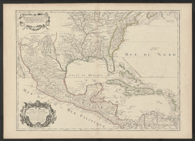
Carte du Mexique et de la Floride des Terres Angloises et des Isles Antilles.
Year
1703
Author
Guillaume de L'Isle
Short Title
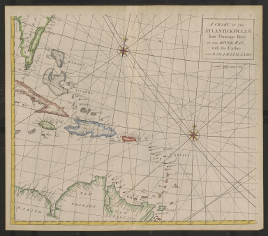
A Chart of the Atlantick Ocean from the Oronoque River to the River May, with the Caribee and Bahama Islands
Year
1728
Short Title
Carolinae, Floridae nec non Insularum Bahamensium : cum partibus adjacendibus ad Exemplar Londinenle in lucem edita
Year
1755
Author
Johann Michael Seligmann
Short Title
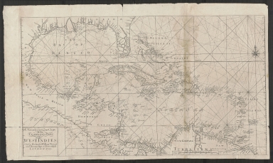
A new and correct large chart of the tradeing part of the West Indies.
Year
1713
Short Title
Indiarum Occidentalium tractus littorales cum insulis Caribicis
Pascaert van West Indien ende Caribise eylanden
Date Range
1680?
1-16 of 16
|