|
REFINE
Browse All : Images from 1848
1-6 of 6
Short Title
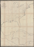
Skeleton map showing the rail roads completed and in progress in the United States and the connection as proposed with the harbor of Pensacola.
Year
1848
Short Title
Phelps's National Map of the United States, A Travellers Guide.
Year
1848
Date Range
1845
Author
J. M. Atwood
Short Title
A February 10, 1848 map by the Surveyor General�s Office in St. Augustine of the 38,000 acre �Claims of Fernanda de la Mara Arredondo� near what is now Lake City, Florida
Year
1848
1-6 of 6
|