|
REFINE
Browse All : Images from 1856
1-23 of 23
Short Title
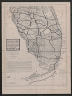
Map of the state of Florida showing the progress of the surveys : from the Annual Report of Surveyor General for 1856.
Year
1856
Author
Columbus Drew
Short Title
Map of the State of Florida, Showing the Progress of the Surveys. Accompanying Annual Report of the Surveyor General for 1856.
Year
1856
Author
John Westcott
Short Title
Map of the State of Florida, Showing the Progress of the Surveys.
Year
1856
Author
John Westcott
Short Title
Map of the State of Florida, Showing the Progress of the Surveys. Accompanying Annual Report of the Surveyor General for 1856.
Year
1856
Author
John Westcott
Short Title
Florida South of Tampa Bay included in Memoir to Accompany Military Map of the Peninsula of Florida South of Tampa Bay, compiled by Lieut. J.C. Ives, Topog'l. Engineers, by order of the Hon. Jefferson Davis, Secretary of War, April 1856, War Department
Year
1856
Author
War Department
Short Title
Military Road Map of South Florida (This is a Overlay of Present Day Roads and Cities to go with 1856 Military Road Map of South Florida 2007.001.081.001)
Year
1856
Short Title
Military map of the Peninsula of Florida South of Tampa Bay, Compiled from the latest and most reliable authorities Map-overlay- present day roads and cities in relation to those of 1856.
Year
1856
Author
J. C. Ives
Short Title
Military map of the Peninsula of Florida South of Tampa Bay, Compiled from the latest and most reliable authorities Map-overlay- present day roads and cities in relation to those of 1856.
Year
1856
Author
J. C. Ives
Short Title
Military map of the Peninsula of Florida South of Tampa Bay, Compiled from the latest and most reliable authorities Map-overlay- present day roads and cities in relation to those of 1856.
Year
1856
Author
J. C. Ives
Short Title
Preliminary Chart of Waccasassa Bay Florida
Year
1856
Author
[F. H. Gerdes, B. Huger Jr., A. M. Harrison]
Short Title
Military Map of Florida South of Tampa Bay
Year
1856
Short Title
U.S. Coast Survey A. D. Bache Preliminary Chart of St. John's River Florida Froom Brown's Creek to Jacksonville 1856
Year
1856
Short Title
A New Map of Florida
Year
1856
Author
Charles DeSilver
Short Title
Physical chart of the Atlantic Ocean.
Year
1856
Author
A. Keith Johnston
Short Title
1856 Military Road Map of South Florida (With Overlay of Present Day Roads and Cities)
Year
1856
Author
Bob Lamme
Short Title
1856 Military Road Map of South Florida (With Overlay of Present Day Roads and Cities)
Year
1856
Author
Bob Lamme
Short Title
Key West, United States Fortifications, Florida
Year
1856
Short Title
U.S. Coast Survey Sketch F Showing the Progress of the Survey in Section VI with a general reconnaissance of the Coast of Florida 1848-56
Year
1856
Author
A. D. Bache
1-23 of 23
|