|
Short Title
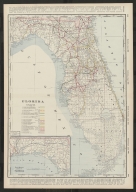
The Rand-McNally new commercial atlas map of Florida.
Year
1913
Author
Rand McNally and Company
Short Title
The Rand-McNally new commercial atlas map of Florida.
Year
1913
Author
Rand McNally and Company
Short Title
Railroad and county map of Florida
Date Range
between 1888 and 1900
Author
George F. Cram
Short Title
Railroad and county map of Florida
Date Range
between 1888 and 1900
Author
George F. Cram
Short Title
Sunshine trails of Florida
Date Range
ca. 1924-1925
Author
Guy McHenry
Short Title
Sunshine trails of Florida
Date Range
ca. 1924-1925
Author
Guy McHenry
Short Title
Historical Map of Florida
Year
1924
Author
American Automobile Association
Short Title
Florida.
Year
1895
Author
Rand McNally and Company
Short Title
Florida.
Year
1895
Author
Rand McNally and Company
Short Title
Rand, McNally & Co's. Florida.
Date Range
1881?
Author
Rand McNally and Company
Short Title
Rand, McNally & Co's. Florida.
Date Range
1881?
Author
Rand McNally and Company
Short Title
Florida.
Date Range
1881-1887
Author
Rand McNally and Company
Short Title
Florida.
Date Range
1881-1887
Author
Rand McNally and Company
Short Title
Railroad and county map of Florida
Date Range
1886-1887
Author
A. A. Grant
Short Title
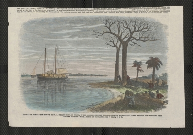
A north view of Pensacola, on the island of Santa Rosa.
Year
1763
Author
Dominic Serres
Short Title
Carta de los canales de Bahama, Providencia y Santaren, costas de la Florida e Isla de Cuba con los cayos y bajos, las islas y sondas adyacentes a esta.
Year
1838
Author
Manuel de Cañas
Short Title
A New and Accurate Map of East and West Florida
Year
1765
Short Title
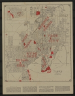
Diagram: of Tampa Land District
Author
A Hoen & Co.
Short Title
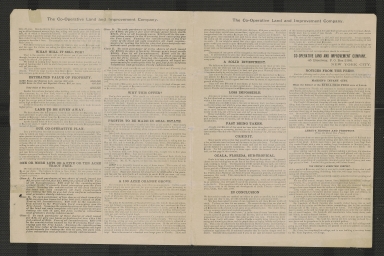
$100,000 worth of valuable real estate to be given absolutely free!
Date Range
1889?
Author
Co-Operative Land and Improvement Company.
Short Title
$100,000 worth of valuable real estate to be given absolutely free!
Date Range
1889?
Author
Co-Operative Land and Improvement Company.
Short Title
Map of Florida according to the latest authorities.
Year
1827
Short Title
Pas kaart van de boght van Florida : met de canaal tusschen Florida en Cuba.
Date Range
1685-1705
Author
Claes Janszoon Vooght
Short Title
S. Augustin
Year
1588
Author
Boazio, Giovanni Battista
Short Title
A Map of Part of West Florida, from Pensacola to the Mouth of the Iberville River, with a View to Shew the Proper Spot for a Settlement on the Mississipi
Year
1772
Author
John Lodge
Short Title
No. 1 A Map of Part of Alabama & Florida. Shewing the route of the proposed Columbus & Pensacola Rail Road.
Year
1836
Author
William R. Palmer
Short Title
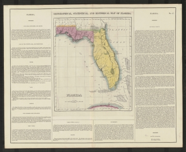
Geographical, Statistical, and Historical Map of Florida
Year
1823
Author
F. Lucas Jr.
Short Title
Geographisch-statistische und historische Charte von Florida
Year
1823
Author
Weiland, C. F.
Short Title
Geographical, Statistical, and Historical Map of Florida
Year
1827
Author
J. Drayton
Short Title
Official Map of the City of Tampa Florida and Vicinity
Year
1940
Short Title
Official Map of the City of Tampa Florida and Vicinity
Year
1940
Short Title
Official Map of the City of Tampa Florida and Vicinity
Year
1940
Short Title
Official Map of the City of Tampa Florida and Vicinity
Year
1940
Short Title
Tampa, Hillsborough County, Florida
Date Range
1960-1968
Author
Greater Tampa Chamber of Commerce
Short Title
Detail Map of Tampa, Clearwater, St. Petersburg & Vicinity
Date Range
ca. 1934
|