|
REFINE
Browse All : Images of North America from 1889
1-7 of 7
Short Title
Map of Caloosahatchee River, Fla., 1887.
Year
1889
Author
J.W. Sackett
Short Title
Improvement to Saint John's River, Florida, 1889.
Year
1889
Author
J.H. Bacon
Short Title
Map of Lake View Highlands, in sect's 4.5.8 and 9, twp. 2.5, r. 21, east, Pasadena, Pasro County, Florida.
Year
1889
Author
J. H. Neff
Short Title
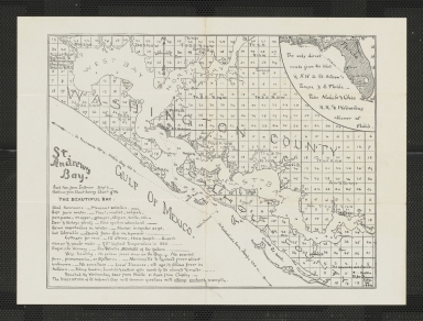
St. Andrew's Bay.
Year
1889
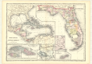
Short Title
West Indies and Central America
Year
1886
Author
William M. Bradley & Bro.
Short Title
Map of North America Showing Direct Passenger Transportation Lines between the United States, Mexico, The West Indies, Central and South America, also Illustrating the Geographical position of Florida and Location of the Railroad, Steamboat and Steamship Lines of the Plant System for Commerce with other States and the Countries South and East of the Gulf of Mexico
Year
1889
1-7 of 7
|