|
Short Title
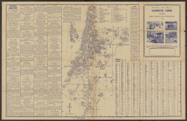
Presenting Your Map of Clearwater, Florida including Belleair, Dunedin, Largo & Safety Harbor
Short Title
The Rand-McNally new commercial atlas map of Florida.
Year
1914
Author
Rand, McNally and Company
Short Title
The Rand-McNally new commercial atlas map of Florida.
Year
1914
Author
Rand, McNally and Company
Short Title
Carta Particolare della Baia di Messico con la Costa
Year
1646
Date Range
1646-1647
Author
Robert Dudley
Short Title
Map to Illustrate the conquest of Florida
Year
1851
Author
J.H. Colton
Short Title
Plan de Pensacola
Year
1728
Author
Antoine Jean Laval
Short Title
[Florida]
Year
1884
Author
Rand McNally and Company
Short Title
[Florida]
Year
1884
Author
Rand McNally and Company
Short Title
Gandy Bridge
Year
1947
Author
Army Map Service
Short Title
Map of Fort Myers, Florida
Year
1947
Author
Dolph, Frank B.
Short Title
Map of Fort Myers, Florida
Year
1947
Author
Dolph, Frank B.
Short Title
The Florida Land and Mortgage Company, Limited
Year
1884
Author
G. W. and C. B. Colton & Co.
Short Title
Charleston Savannah & Florida Steamship Route and Connections
Date Range
1870 - 1873
Short Title
Charleston Savannah & Florida Steamship Route and Connections
Date Range
1870 - 1873
Short Title
Rand, McNally & Co.'s Florida.
Year
1888
Author
Rand McNally and Company
Short Title
Rand, McNally & Co.'s Florida.
Year
1888
Author
Rand McNally and Company
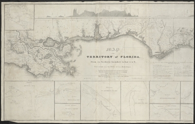
Short Title
Map of the Territory of Florida.
Year
1829
Author
William Henry (W. H.) Swift
Short Title
Land of opportunity, Central Florida
Year
1971
Author
Johnstons Engineers & Surveyors
Short Title
Map of Palm Beach County
Year
1926
Author
Associated Map Co.
Short Title
City of Apalachicola
Year
1874
Author
Apalachicola Land Co.
Short Title
Rand McNally standard map of Florida.
Year
1922
Author
Rand McNally and Company
Short Title
Rand McNally standard map of Florida.
Year
1922
Author
Rand McNally and Company
Short Title
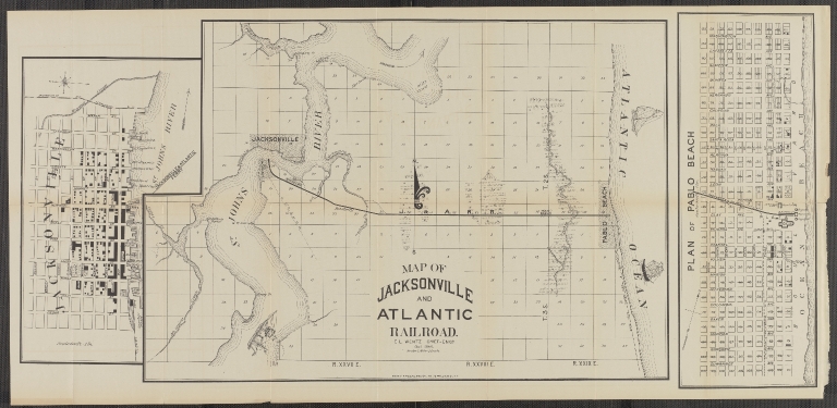
Map of Jacksonville and Atlantic Railroad E.L. Wentz Robert A. Welcke, Photo-Lith. Includes 3 maps
Year
1886
Author
E.L. Wentz
Short Title
Carta Esferica que comprehende todas las Costas Del Seno Mexicano Golfo de Honduras, Islas de Cuba, Sto. Domingo Jamaica Y Lucayas. Direccion Hidrografica de Madrid
Date Range
1808 (corrected to 1813, 1814, and 1846)
Author
Direccion Hidrografica de Madrid
Short Title
Carta Esferica que comprehende todas las Costas Del Seno Mexicano Golfo de Honduras, Islas de Cuba, Sto. Domingo Jamaica Y Lucayas. Direccion Hidrografica de Madrid
Date Range
1808 (corrected to 1813, 1814, and 1846)
Author
Direccion Hidrografica de Madrid
Short Title
America Septentrional Costa Este Hoja I. Florida Con Los Canales De Bahama Y Providencia Direccion de Hidrografia
Year
1867
Author
Direccion de Hidrografia
Short Title
Carta Esferica de las costas del seno mexicano Direccion Hidrografica
Year
1836
Author
Direccion Hidrografica
Short Title
Harbour of St. Augustine in the Province of Georgia
Year
1777
Author
J. F. W. Des Barres
Short Title
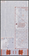
Street map of Tampa ; Street map of St. Petersburg .
Year
1965
Author
H. M. Gousha Company
Short Title
Street map of Tampa ; Street map of St. Petersburg .
Year
1965
Author
H. M. Gousha Company
Short Title
Street map of Miami and Miami Beach.
Year
1959
Author
H. M. Gousha Company
Short Title
Street map of Miami and Miami Beach.
Year
1959
Author
H. M. Gousha Company
Short Title
Street map of Miami and Miami Beach.
Date Range
1950-1953
Author
H. M. Gousha Company
Short Title
Street map of Miami and Miami Beach.
Date Range
1950-1953
Author
H. M. Gousha Company
Short Title
Street map of Miami and Miami Beach.
Date Range
1950-1953
Author
H. M. Gousha Company
Short Title
Street map of Miami and Miami Beach.
Date Range
1950-1953
Author
H. M. Gousha Company
Short Title
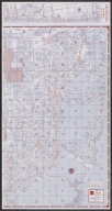
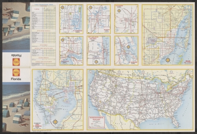
Highway map of Florida.
Year
1956
Author
H. M. Gousha Company
Short Title
Highway map of Florida.
Year
1956
Author
H. M. Gousha Company
Short Title
Highway map of Florida.
Year
1947
Author
H. M. Gousha Company
Short Title
Highway map of Florida.
Year
1947
Author
H. M. Gousha Company
Short Title
Highway map of Florida.
Year
1950
Author
H. M. Gousha Company
Short Title
Highway map of Florida.
Year
1950
Author
H. M. Gousha Company
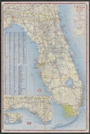
Short Title
Highway map of Florida.
Year
1962
Author
H. M. Gousha Company
Short Title
Highway map of Florida.
Year
1962
Author
H. M. Gousha Company
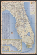
Short Title
Highway map of Florida.
Year
1959
Author
H. M. Gousha Company
Short Title
Highway map of Florida.
Year
1959
Author
H. M. Gousha Company
Short Title
Street map of Miami and Miami Beach.
Date Range
1953?
Author
H. M. Gousha Company
|


![[Florida]](https://luna.tampabayhistorycenter.org/MediaManager/srvr?mediafile=/Size1/TBHC~3~3/24/M938b.jpg)
![[Florida]](https://luna.tampabayhistorycenter.org/MediaManager/srvr?mediafile=/Size1/TBHC~3~3/24/M938a.jpg)