|
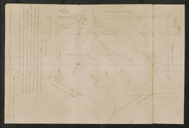
Short Title
Sectional map of St Andrews Bay
Year
1911
Author
St. Andrews Bay Development Co.
Short Title
Map of Florida
Year
1883
Author
Rand McNally & Co.
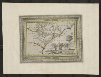
Short Title
Canada Ile feuille
Date Range
1775-1776
Author
Rigobert Bonne
Short Title
Tunison's Florida ; Tunison's Bahama Islands
Year
1903
Author
H. C. Tunison
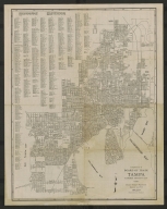
Short Title
Tampa : Florida's greatest city
Year
1927
Author
Tampa Board of Trade
Short Title
Tampa : Florida's greatest city
Year
1927
Author
Tampa Board of Trade
Short Title
Tunison's Florida
Date Range
1900-1904
Author
H. C. Tunison
Short Title
St. Petersburg's Gulf Beaches
Year
1942
Author
Bowman Studios
Short Title
St. Petersburg's Gulf Beaches
Year
1942
Author
Bowman Studios
Short Title
The trail of the pines
Date Range
late 1930s
Author
Lookout Hotel
Short Title
The trail of the pines
Date Range
late 1930s
Author
Lookout Hotel
Short Title
Dade Battlefield
Date Range
1960-1970
Author
Dorothy Dodd
Short Title
Dade Battlefield
Date Range
1960-1970
Author
Dorothy Dodd
Short Title
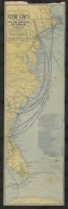
Map showing Clyde Lines and connections
Date Range
ca. 1900
Author
Clyde Steamship Company
Short Title
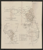
Gomez Grant and Jupiter Island
Year
1893
Author
W. M. Somerville
Short Title
The Florida Times-Union's sectional map of automobile roads in Florida, and through Georgia, Tennessee, North and South Carolina
Year
1923
Author
Florida Times-Union
Short Title
The Florida Times-Union's sectional map of automobile roads in Florida, and through Georgia, Tennessee, North and South Carolina
Year
1923
Author
Florida Times-Union
Short Title
La Florida Under Five Flags
Year
1964
Author
Nikki Beare
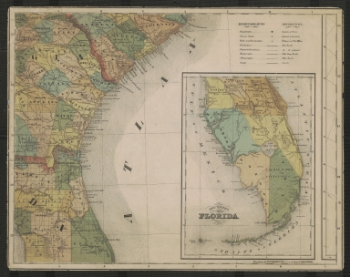
Short Title
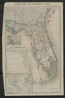
New Map of Florida, 1879
Year
1879
Author
Rand, McNally & Co.
Short Title
New Map of Florida, 1879
Year
1879
Author
Rand, McNally & Co.
Short Title
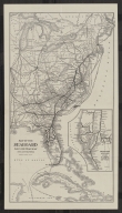
[Map of Miami].
Date Range
ca. 1930-1932
Author
Miami Post Publishing Co.
Short Title
[Map of Miami].
Date Range
ca. 1930-1932
Author
Miami Post Publishing Co.
Short Title
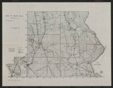
South Florida lands
Date Range
ca. 1922
Author
Jno. W. Pelot
Short Title
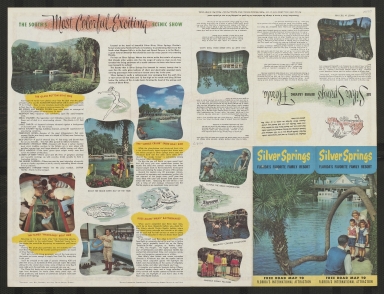
America's finest highways lead to Silver Springs
Year
1953
Author
American Automobile Association
Short Title
America's finest highways lead to Silver Springs
Year
1953
Author
American Automobile Association
Short Title
Goodrich road map of Florida
Year
1919
Author
Raymond Beck
Short Title
Goodrich road map of Florida
Year
1919
Author
Raymond Beck
Short Title
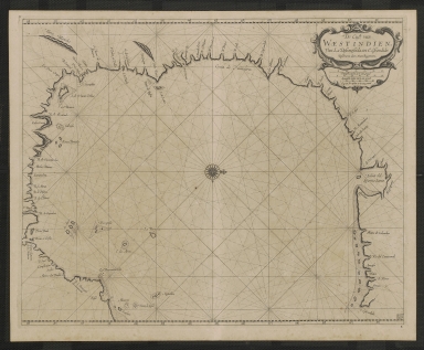
An accurate map of the West Indies, with the adjacent coast of America.
Year
1794
Author
J. Russell
Short Title
Bahama's and Windward Passage
Date Range
ca. 1703-1706
Author
John Thornton
Short Title
A new chart of the Bahama Islands and the Windward Passage
Date Range
1716-1767
Author
Saml. Thornton
Short Title
De Cust van Westindien, van la desconoscida, tot C. Escondido.
Date Range
1675-1680
Author
Arent Roggeveen
Short Title
Map of the Seaboard Air Line Railway and Connections
Year
1914
Author
Mathews-Northrop Works
Short Title
Map of the Seaboard Air Line Railway and Connections
Year
1914
Author
Mathews-Northrop Works
Short Title
Map of Southern States.
Date Range
1844-1850
Author
unknown
Short Title
Manuscript map of northeast portion of East Florida
Year
1816
Author
Jorge Clarke
Short Title
Karte von dem Mexicanischen Meerbusen und dem Inseln von America
Year
1755
Author
Jacques Bellin
Short Title
A map of East and West Florida, Georgia and Louisiana
Year
1781
Short Title
Il paese de selvaggi Outauacesi, e Kilistinesi intorno al Lago Superiore
Date Range
1778-1788
Author
Antonio Zatta
Short Title
Map of the Gulf of Mexico, the islands and countries adjacent
Year
1777
Author
Thomas Kitchin
Short Title
Carta geographica della Florida nell' America settentrionale.
Date Range
1740-1750
Author
Giovanni Battista Albrizzi
Short Title
Zee en Land - Togten der Franszen Gedaan na, en in't Americaans Gewest van Florida, aller-eerst door Ioh. Pontius Ontdekt
Date Range
1706-1714
Author
Pierre vander Aa
Short Title
Virginiae item et Floridae.
Year
1606
Author
Jodocus Hondius
Short Title
Virginiae item et Floridae.
Year
1606
Author
Jodocus Hondius
Short Title
Le Nouveau Mexique et La Floride
Year
1656
Author
N. Sanson
Short Title
A map of the West Indies and middle continent of America from the latest observations
Date Range
1779-1803?
Author
John Blair
Short Title
Cours du Mississipi, comprenant La Louisiane, les 2 Florides, une partie des Etats-Unis, et pays adjacents
Year
1803
Author
J. B. Poirson
|


![[Map of Miami].](https://luna.tampabayhistorycenter.org/MediaManager/srvr?mediafile=/Size1/TBHC~3~3/24/M2005b.jpg)
![[Map of Miami].](https://luna.tampabayhistorycenter.org/MediaManager/srvr?mediafile=/Size1/TBHC~3~3/24/M2005a.jpg)