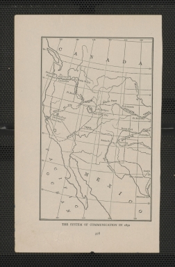
Detail View: Touchton Map Library: The System of Communication in 1850
|
Accession Number:
|
2000.084.083.001
|
|
Short Title:
|
The System of Communication in 1850
|
|
Year:
|
1919
|
|
Geographical Description:
|
depicting the Western half of the United States. shows various trails and connecting stage lines used by travelers such as: the Oregon Trail, the Santa Fe Trail, the Spanish Trail, and the Route of the "Forty Niners". It spans the Pacific Coast to the Mid West and from Canada to Mexico.
|