|
REFINE
Browse All : Images of United States and Mexico
1-18 of 18
Short Title
Carta Esferica que comprehende todas las Costas Del Seno Mexicano Golfo de Honduras, Islas de Cuba, Sto. Domingo Jamaica Y Lucayas. Direccion Hidrografica de Madrid
Date Range
1808 (corrected to 1813, 1814, and 1846)
Author
Direccion Hidrografica de Madrid
Short Title
Carta Esferica que comprehende todas las Costas Del Seno Mexicano Golfo de Honduras, Islas de Cuba, Sto. Domingo Jamaica Y Lucayas. Direccion Hidrografica de Madrid
Date Range
1808 (corrected to 1813, 1814, and 1846)
Author
Direccion Hidrografica de Madrid
Short Title
Carta Esferica de las costas del seno mexicano Direccion Hidrografica
Year
1836
Author
Direccion Hidrografica
Short Title
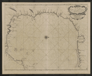
De Cust van Westindien, van la desconoscida, tot C. Escondido.
Date Range
1675-1680
Author
Arent Roggeveen
Short Title
Karte von dem Mexicanischen Meerbusen und dem Inseln von America
Year
1755
Author
Jacques Bellin
Short Title
Map of the Gulf of Mexico, the islands and countries adjacent
Year
1777
Author
Thomas Kitchin
Short Title
Le Nouveau Mexique et La Floride
Year
1656
Author
N. Sanson
Short Title
A map of the West Indies and middle continent of America from the latest observations
Date Range
1779-1803?
Author
John Blair
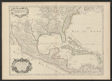
Short Title
Carte du Mexique et de la Floride des Terres Angloises et des Isles Antilles.
Year
1703
Author
Guillaume de L'Isle
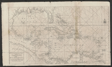
Short Title
A new and correct large chart of the tradeing part of the West Indies.
Year
1713
Short Title
Florida et Apalche.
Year
1598
Author
Cornelis van Wytfliet
Short Title
Florida et Apalche.
Year
1598
Author
Cornelis van Wytfliet
Short Title
Insulae Americanae in Oceano Septentrionali ac Regiones Adiacentes, a C. de May usque ad Lineam Aequinoctialem
Year
1682
Author
Nicolaum Vischer
Short Title
Map of the Straits of Florida and Gulf of Mexico.
Year
1852
Author
U.S. Coast Survey
Short Title
Map of the Straits of Florida and Gulf of Mexico.
Year
1852
Author
U. S. Coast Survey
1-18 of 18
|