WHERE
-
[Map of southern Florida
…
(1)
-
[Pensacola and Mobile are
…
(2)
-
[Pensacola-Mobile area]
(4)
-
[Pensacola-Mobile area].
(2)
-
[Pensacola-Mobile region]
(4)
-
[Pensacola-Mobile region]
…
(2)
-
A Draught of Spirito Sanc
…
(2)
-
A Plan of Pensacola Harbo
…
(1)
-
A Plan of Pensacola Harbo
…
(1)
-
Abaco Island
(1)
-
Africa
(3)
-
Alabama
(29)
-
Alachua
(7)
-
Alachua; Hillsborough
(2)
-
Altamonte Springs
(1)
-
Amelia Island
(2)
-
Anclote Keys
(1)
-
Anna Maria
(1)
-
Apalachicola
(4)
-
Apalachicola River
(1)
-
Apalachicola River area
(2)
-
Aripeka
(2)
-
Arkansas
(1)
-
Asia
(3)
-
At left top inset-Florida
…
(1)
-
Atlantic Coast
(2)
-
Atlantic Coast (Fla.)
(3)
-
Atlantic Coast (U.S.)
(9)
-
Atlantic Intracoastal Wat
…
(1)
-
Atlantic Ocean
(2)
-
Atlantic Ocean; Caribbean
(1)
-
Atlantic Ocean; Gulf of M
…
(1)
-
Atlantic States
(4)
-
Avon Park
(1)
-
Azores
(1)
-
Bahama Islands
(1)
-
Bahamas
(30)
-
Bahia de Matanças int Gr
…
(1)
-
Bahia Honda
(1)
-
Baja Honda int Groodt.
(1)
-
Baker
(2)
-
Baldwin
(2)
-
Banana River
(1)
-
Bar & Entrance of Mobile
…
(1)
-
Bar & Entrance of Pensaco
…
(1)
-
Battle ground of Major Da
…
(2)
-
Battle ground of Major Da
…
(1)
-
Battle ground of Major Da
…
(1)
-
Bay
(2)
-
Bermuda Islands
(1)
-
Big Cypress
(1)
-
Big Pine Key
(2)
-
Black and white map showi
…
(1)
-
Black Hammock Island
(1)
-
Boca Grande
(1)
-
Boca Raton
(3)
-
Border States
(2)
-
Bottom inset: Tampa Bay S
…
(1)
-
bottom portion of Florida
(1)
-
bottom portion of Texas
(1)
-
Braden River
(2)
-
Bradenton
(3)
-
Bradford
(1)
-
Brandon
(2)
-
Brandon Area
(2)
-
Brazil; Cuba; Jamaica; Ba
…
(2)
-
Brevard
(4)
-
Brighton
(1)
-
British East and West Flo
…
(1)
-
British East Florida
(1)
-
Broward
(8)
-
Broward County
(2)
-
Caloosahatchee River
(1)
-
Camp Blanding
(2)
-
Canada
(6)
-
Canal de Bahama
(1)
-
Cape Canaveral
(1)
-
Cape Sable
(1)
-
Caribbean
(2)
-
Caribbean Area
(9)
-
Caribbean; Gulf of Mexico
…
(1)
-
Caroline
(1)
-
Carrabelle
(1)
-
Carte des embouchures du
…
(1)
-
Casey Key
(2)
-
Casselberry
(1)
-
Cedar Key
(1)
-
Cedar Keys
(1)
-
Central America
(6)
-
Central Florida
(2)
-
Central St. Petersburg.
(2)
-
Central Tampa.
(2)
-
Charleston and vicinity
(3)
-
Charleston Harbor
(1)
-
Charlotte
(4)
-
Charlotte Harbor (Bay)
(1)
-
Charlotte Harbor; Sanibel
…
(1)
-
Chart of the currents in
…
(1)
-
Chart of the Eads Jetty S
…
(1)
-
Chart of the mouths of th
…
(3)
-
Chuluota
(1)
-
Citrus
(1)
-
City
(1)
-
City of Temple Terrace.
(4)
-
Civic Center Area
(2)
-
Clay
(3)
-
Clay County
(1)
-
Clearwater
(6)
-
Clermont
(1)
-
Coffin's Patches
(1)
-
Collier
(2)
-
Collier County
(1)
-
Colombia
(1)
-
Color illustration, "Capt
…
(1)
-
Color illustration, "Capt
…
(1)
-
Color illustration, "Exto
…
(1)
-
Color illustration, "The
…
(1)
-
Color illustration, "Then
…
(1)
-
Color illustration, Buffi
…
(1)
-
Color illustration, Judso
…
(1)
-
Color illustration, pirat
…
(1)
-
Color illustration, Sammi
…
(1)
-
Color illustration, two s
…
(1)
-
Color illustration,"Who s
…
(1)
-
Columbia
(2)
-
Comparative elevation of
…
(1)
-
Continuation of Florida
(7)
-
Continuation of Florida.
(3)
-
Continuation of northwest
…
(1)
-
Continuation of Pass-a-Gr
…
(1)
-
Continuation of the Coast
…
(1)
-
Continuation of western F
…
(2)
-
Coral Gables
(3)
-
Costa Rica
(1)
-
Cotee Lake
(1)
-
County Map of North Carol
…
(1)
-
Cross Florida Barge Canal
(2)
-
Crystal River
(1)
-
Cuba
(50)
-
Cuba.
(2)
-
Cuba; Dominican Republic;
…
(1)
-
Cumberland lsland
(1)
-
Cumberland Sound
(2)
-
Dade Battlefield
(1)
-
Dade Battlefield Historic
…
(2)
-
Dade City
(2)
-
Dade County
(2)
-
Dade; Miami Dade
(1)
-
Daytona Beach Shores
(1)
-
Daytona Beach
(7)
-
De Land
(3)
-
De Soto
(10)
-
Deerfield Beach
(2)
-
Del Ray Beach
(1)
-
DeLand
(1)
-
Delray Beach
(2)
-
Der Niagara-Fall und sein
…
(1)
-
Der südliche Teil von Fl
…
(1)
-
Der südliche Teil von Te
…
(1)
-
Distances to Miami
(4)
-
Distances to Miami.
(4)
-
Dixie Highway
(2)
-
Dominican Republic
(2)
-
Downtown Tampa
(8)
-
downtown Tampa
(1)
-
Downtown Tampa.
(22)
-
Dry Tortugas
(36)
-
Dry Tortugas.
(37)
-
Du Noveau Mexique
(1)
-
Dunedin
(2)
-
Duval
(11)
-
Dètroit de la Floride
(1)
-
East (U.S)
(1)
-
East (U.S.)
(1)
-
East Coast of Florida; Ev
…
(2)
-
East Florida
(3)
-
East Florida; West Florid
…
(1)
-
East Tampa
(1)
-
Eastern Entrance to St. G
…
(1)
-
Eastern entrance to St. R
…
(1)
-
Eastern Hemisphere
(1)
-
Eastern portion of the Un
…
(1)
-
Eastern portion of the Un
…
(2)
-
Eastern U.S.
(1)
-
Eastern United States
(2)
-
Eastern United States; At
…
(1)
-
eight regional insets
(2)
-
England
(1)
-
Englewood
(1)
-
Enlarged map of the Tampa
…
(2)
-
Enlarged map of the Tampa
…
(2)
-
Enlarged plan of Pensacol
…
(1)
-
Entrance to Appalachicola
…
(1)
-
Entrance to Mobile Bay Lt
…
(1)
-
Entrance to Ocklockony Ba
…
(1)
-
Entrance to Pensacola Bay
…
(1)
-
Entrance to St. Augustine
…
(1)
-
Entrance to St. John's Ri
…
(1)
-
Entrance to St. Joseph's
…
(1)
-
Entrance to St. Mary's Ha
…
(1)
-
Entrances to St. Andrew's
…
(1)
-
Escambia
(15)
-
Escambia; Monroe
(1)
-
Europe
(6)
-
Europe; Asia; Africa
(3)
-
Evan's Polymetric Table o
…
(1)
-
Everglades
(3)
-
Everglades and Key West
(1)
-
Everglades National Park
(1)
-
Extension of the larger m
…
(1)
-
Fanning Island
(1)
-
Fern Park
(1)
-
Fernandina
(1)
-
Fernandina Beach
(1)
-
Fernandina; Amelia Island
(1)
-
Five road maps showing ho
…
(2)
-
Florida
(1279)
-
Florida (Western section)
(2)
-
Florida and the east coas
…
(2)
-
Florida City
(1)
-
Florida East Coast
(1)
-
Florida Keys
(22)
-
Florida Keys.
(11)
-
Florida Ocidental
(1)
-
Florida Oriental
(1)
-
Florida Panhandle
(9)
-
Florida panhandle
(2)
-
Florida Panhandle; Florid
…
(1)
-
Florida Panhandle; northe
…
(1)
-
Florida Panhandle; northe
…
(1)
-
Florida peninsula
(1)
-
Florida Straits
(1)
-
Florida Territory
(5)
-
Florida West Coast
(2)
-
Florida | Georgia
(2)
-
Florida, Straits of
(1)
-
Florida-Georgia border
(1)
-
Florida; East Florida; We
…
(1)
-
Florida; Georgia
(1)
-
Florida; Georgia; Alabama
(1)
-
Florida; Georgia; Alabama
…
(1)
-
Florida; Georgia; Alabama
…
(2)
-
Florida; Georgia; Alabama
…
(1)
-
Florida; Georgia; South C
…
(3)
-
Florida; Georgia; South C
…
(1)
-
Florida; Georgia; South C
…
(1)
-
Florida; Georgia; South C
…
(1)
-
Floride Occidentale
(1)
-
Floride Orientale
(1)
-
Forest City
(1)
-
Forest Hills - Babe Zahar
…
(2)
-
Forme des balises.
(1)
-
Fort Dallas Park
(2)
-
Fort Lauderdale
(3)
-
Fort Myers
(2)
-
Fort Pierce
(1)
-
Four inset maps show the
…
(1)
-
Franklin
(9)
-
Gadsden
(2)
-
Gandy Bridge
(6)
-
Gateway to Pan America
(2)
-
General map of part of Fl
…
(1)
-
General Map of Part of Fl
…
(1)
-
Geneva
(1)
-
Georgia
(37)
-
Georgia; Florida
(1)
-
Georgia; Florida; Louisia
…
(1)
-
Georgie
(1)
-
Glades
(1)
-
Goldenrod
(1)
-
Green Cove Springs
(1)
-
Greenland
(1)
-
Grove City
(1)
-
Guatemala
(1)
-
Gulf Coast
(1)
-
Gulf Coast (Fla.)
(12)
-
Gulf Coast (Mexico)
(8)
-
Gulf Coast (U.S.)
(19)
-
Gulf of Mexico
(7)
-
Gulf of Mexico; Caribbean
…
(2)
-
Gulf of Mexico; Mexico Ci
…
(1)
-
Gulf States
(4)
-
Gulf Stream
(1)
-
Gulfport
(3)
-
Haines City
(2)
-
Haiti
(2)
-
Halifax River
(2)
-
Harbour of St. Augustine
(5)
-
Harbour of St. Augustine.
(1)
-
Hardee
(2)
-
Havana int Groodt.
(1)
-
Hernando
(3)
-
Highlands
(8)
-
Hilliard
(1)
-
Hillsboro River Drainage
…
(1)
-
Hillsborough
(170)
-
Hillsborough Bay
(3)
-
Hillsborough County
(12)
-
Hillsborough River
(1)
-
Hillsborough; Pinellas
(1)
-
Hilsboro Bay
(1)
-
Hispaniola
(2)
-
Hispanola
(1)
-
Hollywood
(2)
-
Holmes Beach
(1)
-
Holy Hill
(1)
-
Homestead
(2)
-
Homosassa
(1)
-
Honduras
(1)
-
Hours to St. Petersburg f
…
(2)
-
Hudson
(3)
-
Hudson Creek
(1)
-
Ile Ameila
(1)
-
Ile Cumberland
(1)
-
Ile Tiger
(1)
-
Index to Adjoining Sheets
(1)
-
Index to Boundaries
(1)
-
Indian River
(5)
-
Indian River (Lagoon)
(5)
-
Indian River County
(5)
-
Indian Rocks Beach
(2)
-
inset at the lower left c
…
(2)
-
Inset Chart of Key West b
…
(2)
-
Inset maps feature Key We
…
(1)
-
Inset of western Panhandl
…
(1)
-
Inset shows map of Florid
…
(1)
-
Isla de Cuba
(2)
-
Isla de Santo Domingo
(2)
-
Isla Jamayca
(2)
-
Islamorada
(1)
-
Island of New Found Land
(1)
-
Islas Lucayas o de Bahama
(2)
-
Isthmus of Tehuantepec
(1)
-
Jackson
(2)
-
Jacksonville
(20)
-
Jacksonville and Vicinity
(4)
-
Jacksonville and vicinity
(2)
-
Jacksonville to Saint Aug
…
(1)
-
Jacksonville-St. Augustin
…
(3)
-
Jacksonville; Palatka; Ma
…
(1)
-
Jamaica
(10)
-
Jefferson
(1)
-
Jessamine
(1)
-
Jucatan
(1)
-
Jupiter Island
(1)
-
Kennedy Space Center
(2)
-
Kentucky
(4)
-
Key West
(16)
-
Key West as Surveyed Febr
…
(1)
-
Kissimmee
(1)
-
Kissimmee River
(1)
-
Lafayette
(2)
-
Lake
(3)
-
Lake City
(1)
-
Lake County
(4)
-
Lake Mary
(1)
-
Lake Okeechobee
(1)
-
Lake Panasoffkee
(2)
-
Lake Superior
(1)
-
Lake Wales
(3)
-
Lake Worth
(1)
-
Lakeland
(16)
-
Lanark
(2)
-
Largo
(2)
-
Laurel
(1)
-
Lee
(2)
-
Lee County
(3)
-
Leesburg
(2)
-
Lemon Bay
(1)
-
Leo
(1)
-
Leon
(4)
-
Leroy
(9)
-
Les Bermudes
(1)
-
Les costes de la Louisian
…
(1)
-
Levy
(4)
-
Location map : from U.S.C
…
(3)
-
Location map showing Pine
…
(1)
-
Location map, map of Flor
…
(2)
-
Longwood
(1)
-
Looking South from Post O
…
(1)
-
Louisiana
(16)
-
Louisiane
(1)
-
lower peninsula of Florid
…
(1)
-
Lynn Haven
(2)
-
Main Entrance to St. Geor
…
(1)
-
Main entrance to St. Geor
…
(1)
-
Main highways in eastern
…
(1)
-
Maine
(2)
-
Manatee
(16)
-
Manatee River
(4)
-
Map of Florida and the We
…
(9)
-
Map of Florida Panhandle
…
(1)
-
Map of Florida Panhandle.
(2)
-
Map of Florida with steam
…
(1)
-
Map of Greyhound routes t
…
(4)
-
Map of Lee County, Florid
…
(2)
-
Map of North America sout
…
(2)
-
Map of northwest Florida.
(4)
-
Map of northwestern Flori
…
(4)
-
Map of peninsular Florida
…
(1)
-
Map of routes through Geo
…
(2)
-
Map of South Carolina
(1)
-
Map of South Carolina wit
…
(1)
-
Map of southern Florida.
(1)
-
Map of Tampa area (100 mi
…
(4)
-
Map of the Florida Keys a
…
(1)
-
Map showing Georgia, Flor
…
(1)
-
Map showing lines of tran
…
(2)
-
Map showing part of Lake,
…
(1)
-
Map showing part of Lake,
…
(6)
-
Map showing parts of Lake
…
(8)
-
Map showing parts of Lake
…
(2)
-
Map Showing Parts of Lake
…
(1)
-
Map showing parts of Lake
…
(4)
-
Map showing parts of Lake
…
(4)
-
Map showing parts of Lake
…
(2)
-
Map showing parts of Lake
…
(1)
-
Map showing parts of Lake
…
(1)
-
Map showing parts of Lake
…
(2)
-
Map showing parts of Lake
…
(1)
-
Map Showing the Relation
…
(1)
-
Maps Showing the Florida
…
(1)
-
Marianna
(1)
-
Marion
(20)
-
Martin
(2)
-
Merritt Island
(2)
-
Mexico
(20)
-
Mexico, Gulf of
(2)
-
Miami
(32)
-
Miami and Miami Beach
(4)
-
Miami and Vicinity
(4)
-
Miami and vicinity
(4)
-
Miami Beach
(28)
-
Miami Metropolitan Area
(2)
-
Miami-Dade
(29)
-
Miami-Dade County
(2)
-
Miami; Miami Beach
(1)
-
Middle Atlantic States
(3)
-
Middle entrance to St. Ge
…
(1)
-
Middle inset-Old Hillsbor
…
(1)
-
Middle West
(1)
-
Mississippi
(8)
-
Mississippi River
(1)
-
Missouri
(1)
-
Mobile
(9)
-
Mobile.
(5)
-
Monroe
(18)
-
Monroe County
(1)
-
Mosquito Lagoon
(1)
-
Mouths of the Suwanee Riv
…
(1)
-
Mullet Key and vicinity.
(2)
-
Murdock
(1)
-
Myakka City
(1)
-
Myakka River
(1)
-
Nassau
(8)
-
Nassau County
(2)
-
Nassau River
(2)
-
National trails east of t
…
(2)
-
New England
(1)
-
New Mexico
(1)
-
New Port Comfort
(1)
-
New Port Richey
(1)
-
New Providence
(1)
-
New Smyrna
(1)
-
New York
(1)
-
Nicaragua
(1)
-
Nokomis
(1)
-
None
(2)
-
North America
(1370)
-
North America (Caribbean
…
(1)
-
North America; Atlantic O
…
(1)
-
North America; Central Am
…
(1)
-
North America; Europe (sm
…
(1)
-
North America; South Amer
…
(4)
-
North America; South Amer
…
(2)
-
North American continent
…
(1)
-
North Carolina
(13)
-
North Florida
(1)
-
North Orlando
(1)
-
North Palm Beach
(1)
-
North western part of Flo
…
(1)
-
North Western Portion of
…
(1)
-
North western portion of
…
(1)
-
North-western part of Flo
…
(1)
-
North-western portion of
…
(19)
-
North-Western portion of
…
(13)
-
North-Western Portion of
…
(1)
-
North-western portion of
…
(32)
-
northeast Florida
(2)
-
Northeast Florida
(1)
-
northeast Florida; Britis
…
(1)
-
northeast Florida; Britis
…
(1)
-
Northeast Florida; Territ
…
(1)
-
Northern Gulf Coast; Gulf
…
(1)
-
Northwest Florida
(4)
-
Northwest Passage
(1)
-
Northwestern portion of
…
(2)
-
Northwestern Florida
(6)
-
Northwestern Florida.
(2)
-
Northwestern Part of Flor
…
(4)
-
Northwestern part of Flor
…
(3)
-
Northwestern part of Flor
…
(2)
-
Northwestern part of stat
…
(4)
-
Northwestern portion of
…
(13)
-
Northwestern portion of
…
(34)
-
Nouveau Royaume de Leon
(1)
-
Nova Scotia
(1)
-
Ocala
(1)
-
Ochlockonee River; Ochloc
…
(1)
-
Old Spanish Trail
(1)
-
Old Tampa Bay
(2)
-
Olustee; Ocean Pond; nort
…
(1)
-
Orange
(10)
-
Orange Park
(1)
-
Orlando
(9)
-
Ormond Beach
(3)
-
Osceola
(2)
-
Osprey
(1)
-
Oviedo
(1)
-
Palatka
(1)
-
Palm Beach
(9)
-
Palm Harbor
(1)
-
Palmetto
(1)
-
Panama
(3)
-
Panama City
(3)
-
Panhandle of Florida
(1)
-
Parte de la Ysla de Cuba
(1)
-
Pasco
(9)
-
Patrick Air Force Base
(2)
-
Peace River Valley
(1)
-
Pennsylvania
(3)
-
Pensacola
(27)
-
Pensacola Bay
(10)
-
Pensacola Bay Area
(1)
-
Pensacola Bay; Santa Rosa
…
(1)
-
Pensacola-Mobile area
(2)
-
Pensacola-Mobile region
(2)
-
Pensacola-Mobile region.
(6)
-
Pensacola.
(1)
-
Pensacola; Key West
(1)
-
Perdido Bay
(2)
-
Perrine
(1)
-
Pictorial representations
…
(1)
-
Pinellas
(54)
-
Pinellas County
(6)
-
Pinellas Park
(2)
-
Pinellas; Hillsborough; M
…
(1)
-
Placida
(1)
-
Plains States
(1)
-
Plamore
(1)
-
Plan for a new settlement
…
(1)
-
Plan of Charlestown
(1)
-
Plan of government survey
(2)
-
Plan of Grounds and Impro
…
(1)
-
Plan of Pensacola
(2)
-
Plan of St. Augustine
(1)
-
Plan of Tallahassee
(1)
-
Plan of the City of Talla
…
(1)
-
Plan of the Florida Keys
(6)
-
Plan of the Florida Keys
…
(15)
-
Plano de la Aguadilla
(2)
-
Plano del Baxo
(2)
-
Plant City
(1)
-
Polk
(23)
-
Ponce de Leon Inlet
(1)
-
Population of Incorporate
…
(2)
-
Port de Fernandina
(1)
-
Port Everglades
(1)
-
Port of Tampa; Tampa Bay;
…
(2)
-
Port Tampa
(6)
-
Port Tampa City
(1)
-
portion of Florida (Escam
…
(1)
-
portion of Mexico shown w
…
(1)
-
portion of western tip of
…
(1)
-
Principal Highways of Flo
…
(2)
-
Principal products and pr
…
(3)
-
Profile along the sailing
…
(1)
-
Profile along the sailing
…
(1)
-
Profile on line of propos
…
(1)
-
Province of Quebec
(1)
-
Provincia de Yucatan
(1)
-
Punta Gorda
(2)
-
Putnam
(2)
-
Quebec
(1)
-
Ravine State Gardens
(1)
-
Redington Beach
(2)
-
Redland District
(1)
-
Republic of Cuba
(2)
-
Ridgewood
(1)
-
Road map of Florida: From
…
(2)
-
Safety Harbor
(4)
-
Saint Augustine
(1)
-
Saint Johns
(2)
-
Saint Johns River
(14)
-
Saint Marys River
(3)
-
Saint Petersburg
(2)
-
Saint Petersburg Beach
(2)
-
Saint Sebastian River
(5)
-
Saint Vincent Island
(1)
-
Sanford
(1)
-
Sanibel
(1)
-
Sanlando Springs
(1)
-
Santa Rosa
(2)
-
Santa Rosa Island
(1)
-
Sarasota
(13)
-
Sarasota Bay
(2)
-
Savannah and vicinity
(3)
-
Seaboard Air Line around
…
(2)
-
Seabreeze
(2)
-
Sebring
(4)
-
Seminole
(3)
-
Seno Mexicano
(2)
-
Short Canal
(1)
-
Silver Springs
(5)
-
Sketch of Tortugas Island
…
(4)
-
South America
(12)
-
South Atlantic States
(11)
-
South Boundary of General
…
(1)
-
South Carolina
(19)
-
South Florida
(2)
-
South Florida; Southeast
…
(2)
-
South Tampa; Palma Ceia
(1)
-
South-Eastern Portion of
…
(2)
-
Southeast Florida
(1)
-
Southeast United States
(8)
-
Southeastern States
(1)
-
Southeastern United State
…
(3)
-
Southeastern United State
…
(2)
-
Southeastern United State
…
(1)
-
Southeastern United State
…
(1)
-
Southeastern United State
…
(1)
-
Southern Florida Keys.
(1)
-
Southern part of Florida.
(3)
-
Southern part of state
(3)
-
Southern part of state.
(2)
-
Southern part of the Pine
…
(2)
-
Southern portion of Flor
…
(28)
-
Southern portion of Flor
…
(22)
-
Southern portions of Flor
…
(1)
-
Southern States
(37)
-
Southern United States
(1)
-
Spain
(2)
-
Spain; France
(1)
-
Specimen Section official
…
(2)
-
St. Anastatia Island
(1)
-
St. Andrew Bay
(1)
-
St. Andrew's Bay
(2)
-
St. Andrew's Bay (spelled
…
(1)
-
St. Andrews; Gold Town; H
…
(1)
-
St. Augustine
(15)
-
St. Augustine, Ocklawaha
…
(2)
-
St. Augustine; Daytona Be
…
(2)
-
St. George's Island; Apal
…
(1)
-
St. John's River
(1)
-
St. Johns
(9)
-
St. Johns (present day)
(1)
-
St. Johns Cpunty
(1)
-
St. Johns River; northeas
…
(1)
-
St. Lucie
(1)
-
St. Marks River
(2)
-
St. Mary's River
(2)
-
St. Petersburg
(26)
-
St. Petersburg Beach
(1)
-
St. Petersburg; Clearwate
…
(1)
-
St. Petersburg; Gulfport;
…
(2)
-
St.Augustine
(1)
-
State of Florida
(5)
-
state of Florida
(2)
-
State of Florida; souther
…
(1)
-
Ste Marie
(1)
-
Steamship lines from Euro
…
(2)
-
Steamship Lines from Euro
…
(1)
-
Street map of St. Petersb
…
(2)
-
Street map of Tampa showi
…
(2)
-
Street maps of downtown f
…
(2)
-
Streets
(1)
-
Stuart
(1)
-
Sub Sketch Charlotte Harb
…
(1)
-
Sub Sketch of Cedar Keys
(2)
-
Sub sketch of Cedar Keys
(1)
-
Sub Sketch St. John's Riv
…
(1)
-
Sub-Sketch showing the pr
…
(1)
-
Sub-Sketch showing the pr
…
(1)
-
Sumter
(7)
-
Sunshine State Parkway
(2)
-
Supplemento alla Florida
…
(1)
-
Suwannee
(1)
-
Talbot Island
(1)
-
Tallahassee
(7)
-
Tallahassee.
(1)
-
Tampa
(176)
-
Tampa and St. Petersburg
(4)
-
Tampa Bay
(10)
-
Tampa Bay and Vicinity
(4)
-
Tampa Bay and vicinity
(2)
-
Tampa Bay Area
(3)
-
Tampa Bay Region
(5)
-
Tampa Bay Region (Fla.)
(1)
-
Tampa Bay; Fort Brooke
(2)
-
Tampa Bay; south end of t
…
(1)
-
Tampa International Airpo
…
(2)
-
Tampa, FL
(2)
-
Tampa- St. Petersburg dis
…
(2)
-
Tampa-St. Petersburg area
(2)
-
Tangerine
(2)
-
Tarpon Springs
(3)
-
Temple Terrace
(8)
-
Tennessee
(4)
-
Texas
(4)
-
The Bahamas
(1)
-
The coast and river line,
…
(1)
-
The eastern portion of No
…
(1)
-
The Gallapagos Islands
(1)
-
The known world according
…
(1)
-
Tierra Verde and Fort De
…
(2)
-
Titusville
(1)
-
Treasure Island
(3)
-
Two: Jamaica (spelled Iam
…
(1)
-
United Sates
(1)
-
United States
(1349)
-
United States map
(1)
-
United States of America
(5)
-
United States | Cuba
(2)
-
United States; British Co
…
(1)
-
United States; Canada; Me
…
(1)
-
United States; Confederat
…
(1)
-
United States; Cuba; Braz
…
(1)
-
United States; Cuba; Brit
…
(1)
-
United States; Cuba; Domi
…
(1)
-
United States; England
(1)
-
United States; France
(1)
-
United States; Great Brit
…
(2)
-
United States; Mexico; Ca
…
(1)
-
United States; Mexico; Cu
…
(1)
-
United States; Mexico; Cu
…
(1)
-
United States; Northeast;
…
(2)
-
United States; Spain
(1)
-
Unites States
(1)
-
Untitled inset of Florida
…
(1)
-
Venezuela
(1)
-
Venice
(1)
-
Vero Beach
(1)
-
Vicinity Map
(2)
-
View of Gun Cay Light Hou
…
(1)
-
View of Gun Cay Light Hou
…
(1)
-
Virginia
(2)
-
Volusia
(13)
-
Wabasso
(1)
-
Wakulla
(3)
-
Walton
(1)
-
Warrington
(1)
-
Washington; Bay
(1)
-
Washington; Calhoun; Bay
(3)
-
Waterfront of St. Augusti
…
(1)
-
Wauchula
(1)
-
Weekiwachee
(2)
-
West (U.S.)
(1)
-
West Central Florida; Gul
…
(1)
-
West Coast of Florida Anc
…
(1)
-
West Florida
(11)
-
West Indes
(1)
-
West Indies
(17)
-
West Indies and Central A
…
(1)
-
West Indies; Caribbean
(1)
-
West Palm Beach
(3)
-
West Palm Beach and Palm
…
(4)
-
West Palm Beach to Miami
…
(1)
-
West Part of Florida
(2)
-
West part of Florida
(1)
-
West part of Florida.
(2)
-
West Tampa
(1)
-
Western end of state
(2)
-
Western Florida
(29)
-
Western Florida.
(10)
-
Western part of Florida
(5)
-
Western Part of Florida
(1)
-
Western part of Florida.
(4)
-
Western part of state
(1)
-
Western part of state.
(4)
-
Western Portion of Florid
…
(4)
-
western tip of Florida
(1)
-
Westward Extension of Flo
…
(1)
-
Wilmington and vicinity
(3)
-
Windward Passage
(2)
-
Winter Haven
(5)
-
Winter Park
(2)
-
World
(2)
-
Ybor City
(1)
-
Zephyrhills
(3)
Show Less
|
Short Title
Hotel Kissimmee, Kissimmee, Florida.
Author
Cornish Advertising Agency
Author
Miami Beach Chamber of Commerce
Short Title
Tampa Bay Hotel, Tampa, Florida, U.S.A.
Short Title
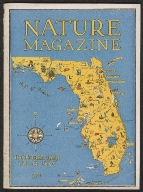
Nature magazine. Volume 14, no. 6, December 1929.
Short Title
Tampa hotels and apartments
Author
Griffith Advertising Agency
Short Title
Tampa, Hillsborough County, Florida
Author
Tampa Chamber of Commerce
Short Title
Florida's delightful West Coast.
Short Title
For a vacation with a future, come to Tampa, Hillsborough County, Florida.
Short Title
The City of Tampa presents: your convention center : Curtis Hixon Convention Hall, showcase for the West Coast.
Author
City of Tampa, Convention Facilities Department
Short Title
Tampa news and views.
Author
[Board of Representatives, City of Tampa, Hillsborough County Board of County Commissioners]
Short Title
Tampa news and views.
Author
[Board of Representatives, City of Tampa, Hillsborough County Board of County Commissioners]
Short Title
St. Petersburg
Short Title
Bradenton Beach
Short Title
Points of Interest and Golf Course Directory
Short Title
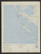
Tarpon Springs
Short Title
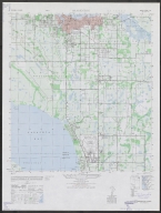
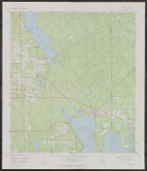
Oldsmar Quadrangle
Short Title
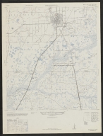
[St. Augustine]
Short Title
Fernandina, Florida : "the ocean city."
Short Title
A city planned solidly for the world of today : Tampa, Florida.
Author
Greater Tampa Chamber of Commerce
Short Title
A city planned solidly for the world of today : Tampa, Florida.
Author
Greater Tampa Chamber of Commerce
Short Title
Florida black velveteen banner with map of Florida; includes images of Florida wildlife and boating
Short Title
Miami souvenir pennant
Short Title
Tampa souvenir pennant
Short Title
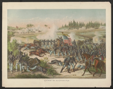
Battle of Olustee, Fla.
Author
McKenney & Hall (Greenough)
Author
McKenney & Hall (Greenough)
Author
McKenney & Hall (Greenough)
Author
McKenney & Hall (Rice & Clark)
Author
McKenney & Hall (Rice & Clark)
Short Title
Florida Y Georgia desde Cabo Canaveral hasta Savannah
Author
Direccion de Hydrografia
Short Title
The Continuation of East Florida, on the same scale.
Short Title
U.S. Coast and Geodetic Survey Temperatures in the Gulf of Mexico and Gulfstream at the Depth of 250 Fathoms
Short Title
Map showing the different lines of survey across Florida for a canal between; Espiritu Santo Bay and the St. John's and Ocklawaha Rivers
Author
[Lieut. M. L. Smith, Lieut. F. T. Byran, A. E. Drake]
Short Title
Map showing the different lines of survey across Florida for a canal between; Espiritu Santo Bay and the St. John's and Ocklawaha Rivers
Author
[Lieut. M. L. Smith, Lieut. F. T. Byran, A. E. Drake]
Short Title
Map showing the different lines of survey across Florida for a canal between; Espiritu Santo Bay and the St. Johns and Ocklawaha Rivers Lieut. M. L. Smith, Lieut. F. T. Bryanand A. E. Drake Ackerman Lith.
Author
Lieut. M. L. Smith, Lieut. F. T. Bryanand A. E. Drake
Short Title
Florida Official Transportation Map
Short Title
Florida Official Transportation Map
Short Title
Official Florida 1976 Bicentennial Map (Official Road Map Florida)
Short Title
Official Florida 1976 Bicentennial Map (Official Road Map Florida)
|


![[St. Augustine]](https://luna.tampabayhistorycenter.org/MediaManager/srvr?mediafile=/Size1/TBHC~3~3/316/2003064015_0001.jpg)