Browse All

1836 Land District East Territory … |

- Land District East Territo … March 10, 1835 |

1923 Association of the Chambers … The truth about the Dixie Hi … |
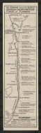
1923 Association of the Chambers … The truth about the Dixie Hi … |
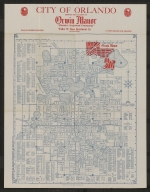
1926 Florida Associated Engineers … City of Orlando, showing the … |
George F. Cram Florida 1905? |
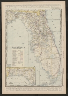
George F. Cram Florida 1905? |

1898 Benyaurd, William H.H. Map of Hillsboro Bay, Fla. |

1743 Isaak Tirion Gezigt van't Spaansche vlek … |
1889 Public Park at Saint Augusti … |
1889 Public Park at Saint Augusti … |

Co-Operative Land and Improv … Florida's phenomenal city, L … 1890-1891? |

Co-Operative Land and Improv … Florida's phenomenal city, L … 1890-1891? |
The Household Companion Winner of rebus contest. 1890-1891? |
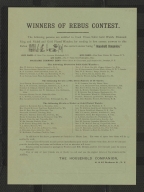
The Household Companion Winner of rebus contest. 1890-1891? |

1932 United States. Bureau of Pub … The Federal Aid Highway Syst … |

1925 [John Nolen, Philip W. Foste San Jose, Florida. |

1864 United States Coast Survey Balisage des Récifs de la F … |

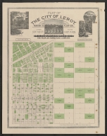
Co-Operative Land and Improv … Plat of the City of Leroy, M … ca. 1890 |

1890 Co-Operative Land and Improv … A little story of Leroy. |

1890 Co-Operative Land and Improv … A little story of Leroy. |
The People's Homestead Compa … Plat of the city of Leroy, M … 1890s? |

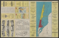
Rube Allyn Rube Allyn's authentic fishi … 1957? |
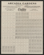
Coughlan and Company, Inc. Arcadia Gardens, De Soto Cou … 1925? |
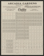
Coughlan and Company, Inc. Arcadia Gardens, De Soto Cou … 1925? |

Coughlan and Company, Inc. Arcadia Gardens, De Soto Cou … 1925? |

Coughlan and Company, Inc. Arcadia Gardens, De Soto Cou … 1925? |
1949 George L. Van Sciver Van Sciver's new authentic p … |
1949 George L. Van Sciver Van Sciver's new authentic p … |

1918 Geographical Publishing Comp … Florida. |
1918 Geographical Publishing Comp … Florida. |
Matthaei Seutteri Accurata delineatio celeberr … 1734? |

Harold Radcliffe City of Gulfport. ca. 1950 |

Harold Radcliffe City of Gulfport. ca. 1950 |

Harold Radcliffe City of Gulfport. ca. 1950 |
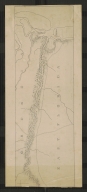
1835 [Washington Hood, Richard S. Pensacola harbor and bar : s … |
Frank B. Dolph Company Map of Florida. 1946-1950 |
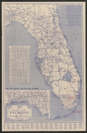
Frank B. Dolph Company Map of Florida. 1946-1950 |
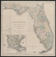
1882 G. W. and C. B. Colton & Co. Map of the State of Florida … |

1888 G. W. and C. B. Colton & Co. New township map of the stat … |

1925 Parklap Engineering and Surv … Guide map of St. Petersburg, … |

1934 A.L. Pfau Plat showing island south of … |
George F. Cram Florida. 1895-1899 |

George F. Cram Florida. 1895-1899 |

R. & J. Ottens Nova Tabula Exhibens Insulas … c. 1735 ? |
[Map of northeast Florida al … ca. 1815 |
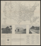
1929 Florida State Road Departmen … Official Road Map of Florida |

1929 Florida State Road Departmen … Official Road Map of Florida |

1760 Thomas Jefferys Pais Cedes, Sheet 1st, conta … |

Giuseppe Pazzi Piano del Porto, e degli sta … 1763? |