|
REFINE
Media Group: The Shape We're In
1-24 of 24
Short Title
untitled map of the Caribbean
Year
1511
Author
Andrea Morales
Short Title
untitled map of the Caribbean
Year
1511
Author
Andrea Morales
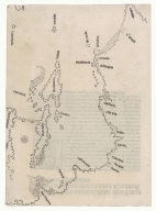
Short Title
Untitled map of Tenochtitlán and the Gulf of Mexico (facsimile)
Year
1524
Author
Hernán Cortés
Short Title
Carta Marina Nvova Tavola
Year
1562
Author
Girolamo Ruscelli
Short Title
Carta Marina Nvova Tavola
Year
1562
Author
Girolamo Ruscelli
Short Title
Florida, et Regiones Vicinae
Year
1630
Author
Johannes de Laet
Short Title
Carta Particolare della Baia di Messico con la Costa
Year
1646
Date Range
1646-1647
Author
Robert Dudley
Short Title
A General Chart of the West India
Year
1683
Author
John Thornton
Short Title
1692 (dealer date) map by S. U. Muller of the southeast U. S. (to eastern Mexico) titled Florida hieffe[?] vorzeiten Jaquaza, theilet fich: - plate VI.c from what seems to be Muller's 1692 atlas printed in Ulm, Germany.
Year
1692
Author
S. U. Muller
Short Title
1692 (dealer date) map by S. U. Muller of the southeast U. S. (to eastern Mexico) titled Florida hieffe[?] vorzeiten Jaquaza, theilet fich: - plate VI.c from what seems to be Muller's 1692 atlas printed in Ulm, Germany.
Year
1692
Author
S. U. Muller
Short Title
A Chart of the Bay of Mexico from Cape Florida to Cape Roxo
Year
1703
Author
Charles Price
Short Title
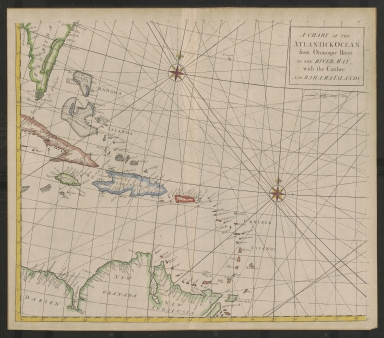
A Chart of the Atlantick Ocean from the Oronoque River to the River May, with the Caribee and Bahama Islands
Year
1728
Short Title
Carte reduite du Golphe du Mexique et des Isles de l'Amerique pour servir aux vaisseaux du Roy. Dressee Au Depost des cartes et plans de la Marine par ordre de M. Le Comte de Maurepas.
Year
1749
Author
Jacques Nicolas Bellin
Short Title
A New and Correct Chart of the Trading Part of the West Indies
Year
1758
Short Title
Civil War in America…Read’s Grand Panoramic View of the Free and Confederated Slave States of America
Year
1861
Author
Capt. Harrison
Short Title
Civil War in America…Read’s Grand Panoramic View of the Free and Confederated Slave States of America
Year
1861
Author
Capt. Harrison
Short Title
Teatre of Military Operations in Florida During 1835, 1836 & 1837
Year
1837
Short Title
Florida
Year
1836
Author
Thomas Gamaliel Bradford
Short Title
Carte Reduite des Cotes et de l'Interieur de la Presqu'ile de la Florida
Year
1780
Short Title
East Florida, from surveys made since the last peace, adapted to Dr. Stork's history of that country.
Year
1769
Author
Thomas Jefferys
Short Title
A New Map of East Florida
Date Range
1760s
Author
William Stork
Short Title
Carte réduite des costes de la Louisiane et de la Floride.
Year
1764
Author
Jacques Nicolas Bellin
Short Title
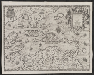
Occidentalis Americae partis, vel, earum Regionum...
Year
1594
1-24 of 24
|


![1692 (dealer date) map by S. U. Muller of the southeast U. S. (to eastern Mexico) titled Florida hieffe[?] vorzeiten Jaquaza, theilet fich: - plate VI.c from what seems to be Muller's 1692 atlas printed in Ulm, Germany.](https://luna.tampabayhistorycenter.org/MediaManager/srvr?mediafile=/Size1/TBHC~3~3/108/2018.123.001-01.jpg)
![1692 (dealer date) map by S. U. Muller of the southeast U. S. (to eastern Mexico) titled Florida hieffe[?] vorzeiten Jaquaza, theilet fich: - plate VI.c from what seems to be Muller's 1692 atlas printed in Ulm, Germany.](https://luna.tampabayhistorycenter.org/MediaManager/srvr?mediafile=/Size1/TBHC~3~3/108/2018.123.001-02.jpg)