|
Short Title
Topographical map of the Tampa Quadrangle from 1969. The map was produced by the United States Department of the Interior Geological Survey and is of the Florida - Hillsborough Co. 7.5 Minute Series (Topographic). The map's subject is noted as Tampa, Fla. N22752.5 - W8222.5/7.5. Originally mapped, edited and published by the Geological Survey with control by the USGS [United States Geological Survey], the USC&GS [United States Coast and Geodetic Survey], and the USCE [United States Corps of Engineers]. The map is based off of aerial photographs from 1954, topographical surveys of 1956, and partially revised using aerial photographs taken in 1969. The red tinted areas on the map indicate "areas in which only landmark buildings are shown." Any areas or locations in purple are revisions based off of the 1969 aerial photographs.
Year
1969
Short Title
Topographical map of the Tampa Quadrangle from 1981. The map was produced by the United States Department of the Interior Geological Survey and is of the Florida - Hillsborough Co. 7.5 Minute Series (Topographic). The map's subject is noted as Tampa, Fla. N22752.5 - W8222.5/7.5. Originally mapped, edited and published by the Geological Survey with control by the USGS [United States Geological Survey], the USC&GS [United States Coast and Geodetic Survey], and the USCE [United States Corps of Engineers]. The map is based off of aerial photographs from 1954, topographical surveys of 1956, and partially revised using aerial photographs taken in 1979. Map was edited and published in 1981. The red tinted areas on the map indicate "areas in which only landmark buildings are shown." Any areas or locations in purple are revisions based off of 1979 aerial photographs which indicate the extension of urban areas.
Year
1981
Short Title
Topographical map of the Tampa Quadrangle from 1981. The map was produced by the United States Department of the Interior Geological Survey and is of the Florida - Hillsborough Co. 7.5 Minute Series (Topographic). The map's subject is noted as Tampa, Fla. N22752.5 - W8222.5/7.5. This map is an identical copy of record (2018.031.002) but has "Wright State University Library" stamped onto the top of the map. Originally mapped, edited and published by the Geological Survey with control by the USGS [United States Geological Survey], the USC&GS [United States Coast and Geodetic Survey], and the USCE [United States Corps of Engineers]. The map is based off of aerial photographs from 1954, topographical surveys of 1956, and partially revised using aerial photographs taken in 1979. Map was edited and published in 1981. The red tinted areas on the map indicate "areas in which only landmark buildings are shown." Any areas or locations in purple are revisions based off of 1979 aerial photographs which indicate the extension of urban areas.
Year
1981
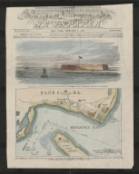
Short Title
Topographical map of the Port Tampa Quadrangle from 1981. The map was produced by the United States Department of the Interior Geological Survey and is of the Florida 7.5 Minute Series (Topographic). The map's subject is noted as Port Tampa, Fla. N2745 - W8230/7.5. Originally mapped, edited and published by the Geological Survey with control by the USGS [United States Geodetic Survey], the NOS/NOAA [National Oceanic and Atmospheric Association], and the Florida Geodetic Survey. The map is based off of aerial photographs from 1954, topographical surveys of 1956, and hydropgraphic data from NOS chart 587 (1952). Areas where only landmark buildings are shown are tinted in red. Revisions to the map are shown in purple based off of aerial photos from 1979, indicating the extension of urban areas. The map was edited and published in 1981. Near the bottom right border there is a "Property of Ohio State University Museum of Zoology" stamp.
Year
1981
Short Title
Topographical map of the St. Petersburg Quadrangle from 1969. The map was produced by the United States Department of the Interior Geological Survey and is of the Florida - Pinellas Co. 7.5 Minute Series (Topographic). The map's subject is noted as St.Petersburg, Fla. N2745 - W8237.2/7.5. Originally mapped, edited and published by the Geological Survey with control by the USGS [United States Geodetic Survey], the USC&GS [United States Coast and Geodetic Survey], and the Florida Geodetic Survey. The map is based off of aerial photographs from 1954, topographical surveys of 1956, hydrogaphic data from USC&GS charts 587 and 1257 (1953),and was partially revised using aerial photographs taken in 1969. The red tinted areas on the map indicate "areas in which only landmark buildings are shown." Any areas or locations in purple are revisions based off of 1969 aerial photographs which indicate the extension of urban areas. In the bottom right corner of the document there is a "Property of The Ohio State University Museum of Zoology" stamp but this has been crossed out in pen with the addition of "triplicate 14 Feb 83."
Year
1969
Short Title
Topographical map of the St. Petersburg Quadrangle from 1969. The map was produced by the United States Department of the Interior Geological Survey and is of the Florida - Pinellas Co. 7.5 Minute Series (Topographic). The map's subject is noted as St.Petersburg, Fla. N2745 - W8237.2/7.5. This map is an identical copy of record (2018.031.005). Originally mapped, edited and published by the Geological Survey with control by the USGS [United States Geodetic Survey], the USC&GS [United States Coast and Geodetic Survey], and the Florida Geodetic Survey. The map is based off of aerial photographs from 1954, topographical surveys of 1956, hydrogaphic data from USC&GS charts 587 and 1257 (1953),and was partially revised using aerial photographs taken in 1969. The red tinted areas on the map indicate "areas in which only landmark buildings are shown." Any areas or locations in purple are revisions based off of 1969 aerial photographs which indicate the extension of urban areas. In the bottom right corner of the document there is a "Property of The Ohio State University Museum of Zoology" stamp.
Year
1969
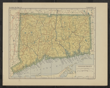
Short Title
1867 County map of Florida by S. Augustus Mitchell, Jr. Map also includes a county map of North Carolina and South Carolina, and a a view of the Charleston Harbor.
Year
1867
Short Title
Map of the Southern States with Arkansas & Tennessee, dated 1873. Six southern states are described on the back of the map, including Florida. Descriptions include information about productions and towns. Map has "1873" and "$35.00" written in pencil at top corners.
Year
1873
Short Title
Map of the Southern States with Arkansas & Tennessee, dated 1873. Six southern states are described on the back of the map, including Florida. Descriptions include information about productions and towns. Map has "1873" and "$35.00" written in pencil at top corners.
Year
1873
Short Title
Railroad and town map of Florida dated 1921. Includes a map of Connecticut on the reverse.
Year
1921
Author
L.L. Poates Engr'g Co.
Short Title
Railroad and town map of Florida dated 1921. Includes a map of Connecticut on the reverse.
Year
1921
Author
L.L. Poates Engr'g Co.
Short Title
Map of the southern United States, Cuba, Haiti, Puerto Rico, and the Bahamas entitled, Sudostliche Vereinigte Staaten, Cuba und Bahama-Inseln. Map has "$48.00" and "1911" written in pencil at bottom corners. Although map has the written date 1911, David Rumsey dates the same map to 1905.
Year
1905
Short Title
Welcome Explore! The Authentic Old Jail in the Nation's Oldest City St. Augustine, Florida
Date Range
c. 1960s
Short Title
Welcome Explore! The Authentic Old Jail in the Nation's Oldest City St. Augustine, Florida
Date Range
c. 1960s
Short Title
Florida resorts
Year
1934
Author
Atlantic Coast Line Railroad
Short Title
Florida resorts
Year
1934
Author
Atlantic Coast Line Railroad
Short Title
undated menu of "Luigi's Restaurant" in Key West (Established 1947) with a map indicating "Points of Interest in Key West."
Short Title
undated menu of "Luigi's Restaurant" in Key West (Established 1947) with a map indicating "Points of Interest in Key West."
Short Title
"Daytona Beach Recreational Area Pictorial Guide". Undated with artists' names shown at lower right of the colorful map.
Short Title
"Daytona Beach Recreational Area Pictorial Guide". Undated with artists' names shown at lower right of the colorful map.
Short Title
Motor Tours via Southern Tours, Inc.
Date Range
c. 1950s
Short Title
Motor Tours via Southern Tours, Inc.
Date Range
c. 1950s
Short Title
April 15, 1962 "Official Map" of "Eglin Air Force Base, Florida" prepared by the Office of Information of the Air Proving Ground Center/Air Force Systems Command.
Year
1962
Short Title
April 15, 1962 "Official Map" of "Eglin Air Force Base, Florida" prepared by the Office of Information of the Air Proving Ground Center/Air Force Systems Command.
Year
1962
Short Title
"Crystal River Fishing Guide" from Achbach Printing in Crystal River. Shows navigation channels, fishing locations and water depths.
Year
1971
Short Title
October 2, 1957 maps of Marion County and Ocala - published and copyrighted by Moorehead (elsewhere spelled Moorhead) Engineering Co. "Compliments of Ocala-Marion County Chamber of Commerce".
Year
1957
Short Title
October 2, 1957 maps of Marion County and Ocala - published and copyrighted by Moorehead (elsewhere spelled Moorhead) Engineering Co. "Compliments of Ocala-Marion County Chamber of Commerce".
Year
1957
Short Title
Travel the Photogenic Dixieland Route between the Eastern States and Florida's West Coast
Date Range
c. 1950s
Short Title
Travel the Photogenic Dixieland Route between the Eastern States and Florida's West Coast
Date Range
c. 1950s
Short Title
1960 "Section Map of Collier County, Florida" by Webb Realty Corporation of Miami. Shows township and range lines. Extensive markings by a previous owner.
Year
1960
Short Title
1960 "Section Map of Collier County, Florida" by Webb Realty Corporation of Miami. Shows township and range lines. Extensive markings by a previous owner.
Year
1960
Short Title
1902 (says dealer) lithographed map of Florida from the Anglo-American Encyclopedia and Dictionary (Volume II) published by the Avil Printing Company, Philadelphia.
Year
1902
Short Title
A colorful placemat of FLORIDA.� Undated, but with code 11-0936 in lower right corner with the words Dollar-wise and Springprint (copyrighted by�).
Short Title
Dade City, San Antonio, Land O' Lakes area of Pasco County
Short Title
Dade City, San Antonio, Land O' Lakes area of Pasco County
Short Title
Florida
Year
1930
Author
National Geographic Society
Short Title
Old Spanish Trail Travel Bulletin
Year
1931
Short Title
Old Spanish Trail Travel Bulletin
Year
1931
Short Title
Old Spanish Trail Travel Bulletin
Date Range
ca. 1934
Short Title
Old Spanish Trail Travel Bulletin
Date Range
ca. 1934
|
![Topographical map of the Tampa Quadrangle from 1969. The map was produced by the United States Department of the Interior Geological Survey and is of the Florida - Hillsborough Co. 7.5 Minute Series (Topographic). The map's subject is noted as Tampa, Fla. N22752.5 - W8222.5/7.5. Originally mapped, edited and published by the Geological Survey with control by the USGS [United States Geological Survey], the USC&GS [United States Coast and Geodetic Survey], and the USCE [United States Corps of Engineers]. The map is based off of aerial photographs from 1954, topographical surveys of 1956, and partially revised using aerial photographs taken in 1969. The red tinted areas on the map indicate "areas in which only landmark buildings are shown." Any areas or locations in purple are revisions based off of the 1969 aerial photographs.](https://luna.tampabayhistorycenter.org/MediaManager/srvr?mediafile=/Size1/TBHC~3~3/115/2018.031.001.jpg)
![Topographical map of the Tampa Quadrangle from 1981. The map was produced by the United States Department of the Interior Geological Survey and is of the Florida - Hillsborough Co. 7.5 Minute Series (Topographic). The map's subject is noted as Tampa, Fla. N22752.5 - W8222.5/7.5. Originally mapped, edited and published by the Geological Survey with control by the USGS [United States Geological Survey], the USC&GS [United States Coast and Geodetic Survey], and the USCE [United States Corps of Engineers]. The map is based off of aerial photographs from 1954, topographical surveys of 1956, and partially revised using aerial photographs taken in 1979. Map was edited and published in 1981. The red tinted areas on the map indicate "areas in which only landmark buildings are shown." Any areas or locations in purple are revisions based off of 1979 aerial photographs which indicate the extension of urban areas.](https://luna.tampabayhistorycenter.org/MediaManager/srvr?mediafile=/Size1/TBHC~3~3/115/2018.031.002.jpg)
![Topographical map of the Tampa Quadrangle from 1981. The map was produced by the United States Department of the Interior Geological Survey and is of the Florida - Hillsborough Co. 7.5 Minute Series (Topographic). The map's subject is noted as Tampa, Fla. N22752.5 - W8222.5/7.5. This map is an identical copy of record (2018.031.002) but has "Wright State University Library" stamped onto the top of the map. Originally mapped, edited and published by the Geological Survey with control by the USGS [United States Geological Survey], the USC&GS [United States Coast and Geodetic Survey], and the USCE [United States Corps of Engineers]. The map is based off of aerial photographs from 1954, topographical surveys of 1956, and partially revised using aerial photographs taken in 1979. Map was edited and published in 1981. The red tinted areas on the map indicate "areas in which only landmark buildings are shown." Any areas or locations in purple are revisions based off of 1979 aerial photographs which indicate the extension of urban areas.](https://luna.tampabayhistorycenter.org/MediaManager/srvr?mediafile=/Size1/TBHC~3~3/115/2018.031.003.jpg)
![Topographical map of the Port Tampa Quadrangle from 1981. The map was produced by the United States Department of the Interior Geological Survey and is of the Florida 7.5 Minute Series (Topographic). The map's subject is noted as Port Tampa, Fla. N2745 - W8230/7.5. Originally mapped, edited and published by the Geological Survey with control by the USGS [United States Geodetic Survey], the NOS/NOAA [National Oceanic and Atmospheric Association], and the Florida Geodetic Survey. The map is based off of aerial photographs from 1954, topographical surveys of 1956, and hydropgraphic data from NOS chart 587 (1952). Areas where only landmark buildings are shown are tinted in red. Revisions to the map are shown in purple based off of aerial photos from 1979, indicating the extension of urban areas. The map was edited and published in 1981. Near the bottom right border there is a "Property of Ohio State University Museum of Zoology" stamp.](https://luna.tampabayhistorycenter.org/MediaManager/srvr?mediafile=/Size1/TBHC~3~3/115/2018.031.004.jpg)
![Topographical map of the St. Petersburg Quadrangle from 1969. The map was produced by the United States Department of the Interior Geological Survey and is of the Florida - Pinellas Co. 7.5 Minute Series (Topographic). The map's subject is noted as St.Petersburg, Fla. N2745 - W8237.2/7.5. Originally mapped, edited and published by the Geological Survey with control by the USGS [United States Geodetic Survey], the USC&GS [United States Coast and Geodetic Survey], and the Florida Geodetic Survey. The map is based off of aerial photographs from 1954, topographical surveys of 1956, hydrogaphic data from USC&GS charts 587 and 1257 (1953),and was partially revised using aerial photographs taken in 1969. The red tinted areas on the map indicate "areas in which only landmark buildings are shown." Any areas or locations in purple are revisions based off of 1969 aerial photographs which indicate the extension of urban areas. In the bottom right corner of the document there is a "Property of The Ohio State University Museum of Zoology" stamp but this has been crossed out in pen with the addition of "triplicate 14 Feb 83."](https://luna.tampabayhistorycenter.org/MediaManager/srvr?mediafile=/Size1/TBHC~3~3/115/2018.031.005.jpg)
![Topographical map of the St. Petersburg Quadrangle from 1969. The map was produced by the United States Department of the Interior Geological Survey and is of the Florida - Pinellas Co. 7.5 Minute Series (Topographic). The map's subject is noted as St.Petersburg, Fla. N2745 - W8237.2/7.5. This map is an identical copy of record (2018.031.005). Originally mapped, edited and published by the Geological Survey with control by the USGS [United States Geodetic Survey], the USC&GS [United States Coast and Geodetic Survey], and the Florida Geodetic Survey. The map is based off of aerial photographs from 1954, topographical surveys of 1956, hydrogaphic data from USC&GS charts 587 and 1257 (1953),and was partially revised using aerial photographs taken in 1969. The red tinted areas on the map indicate "areas in which only landmark buildings are shown." Any areas or locations in purple are revisions based off of 1969 aerial photographs which indicate the extension of urban areas. In the bottom right corner of the document there is a "Property of The Ohio State University Museum of Zoology" stamp.](https://luna.tampabayhistorycenter.org/MediaManager/srvr?mediafile=/Size1/TBHC~3~3/115/2018.031.006.jpg)