|
Short Title
Map of Florida and the West Indies.
Year
1899
Author
Florida East Coast Railway
Short Title
New map of the city of Orlando, Florida
Year
1935
Author
A. Clague
Short Title
New map of the city of Orlando, Florida
Year
1935
Author
A. Clague
Short Title
Revised map of Berkeley, Hernando County, Florida.
Date Range
19??
Short Title
Revised Map of Berkeley, Hernando County, Florida.
Date Range
19??
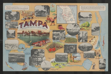
Short Title
Tampa, the vacation capitol of South Florida.
Date Range
1939?
Author
Tampa Chamber of Commerce
Short Title
Tampa, the vacation capitol of South Florida.
Date Range
1939?
Author
Tampa Chamber of Commerce
Short Title
Map of the city of Miami and environs
Year
1926
Author
Sauer and Seghy
Short Title
Map of the city of Miami
Year
1925
Author
Sauer and Seghy
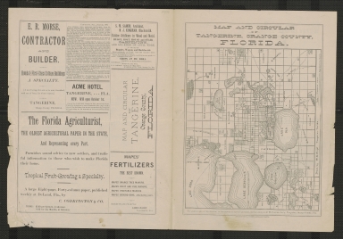
Short Title
Map and circular of Tangerine, Orange County, Florida.
Year
1883
Author
W. G. Wright
Short Title
Map and circular of Tangerine, Orange County, Florida.
Year
1883
Author
W. G. Wright
Short Title
Plan de la baye de Pansacola.
Year
1744
Author
Jacques Nicolas Bellin
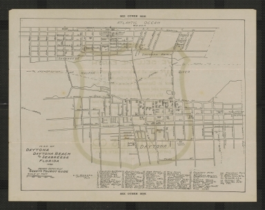
Short Title
Map of Daytona, Daytona Beach, and Seabreeze, Florida
Year
1920
Author
C. M. Rogers
Short Title
Map of Daytona, Daytona Beach, and Seabreeze, Florida
Year
1920
Author
C. M. Rogers
Short Title
D. Carolina nebst einem Theil von Florida.
Year
1737
Author
Homann Heirs (Johann Baptist Homann)
Short Title
Florida East Coast Railway.
Date Range
1920s
Author
Florida East Coast Railway.
Short Title
Florida East Coast Railway.
Date Range
1920s
Author
Florida East Coast Railway.
Short Title
Map of Jacksonville, Tampa, and Key West system and connections.
Date Range
1889?
Author
Matthews-Northrup Company
Short Title
Ace Comstock, Pavilion, Safety Harbor, Florida.
Date Range
1920s
Author
Ace Comstock
Short Title
Ace Comstock, Pavilion, Safety Harbor, Florida.
Date Range
1920s
Author
Ace Comstock
Short Title
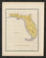
Florida.
Date Range
1830s
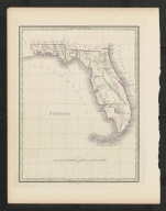
Short Title
Florida.
Date Range
1830s
Short Title
Carte de la Floride Francaise (1562-1568).
Year
1875
Author
Paul Gaffarel
Short Title
Carta rappresentante la Penisola della Florida.
Date Range
1763?
Author
Andrea Scacciati
Short Title
Plan of a part of the front of the city of Saint Augustine, Florida, and of Fort Marion and the sea wall.
Date Range
1840s?
Short Title
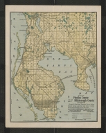
Map of Pinellas County and west part of Hillsborough County, Florida.
Date Range
1924-1934
Author
George F. Cram Company
Short Title
Friendly Service offices in Florida.
Date Range
1940s-early 1950s?
Author
Friendly Service, Inc.
Short Title
Friendly Service offices in Florida.
Date Range
1940s-early 1950s?
Author
Friendly Service, Inc.
Short Title
Map no. 5, United States.
Year
1847
Author
Cady & Burgess
Short Title
Map no. 5, United States.
Year
1853
Author
Daniel Burgess & Co.
Short Title
Map no. 5, United States.
Year
1853
Author
Daniel Burgess & Co.
Short Title
De Land and adjacent parts of Volusia County.
Year
1936
Author
C.R. Swanton
Short Title
Tourist map of Florida [top half]
Year
1932
Author
W. E. Hunt
Short Title
Tourist map of Florida [bottom half]
Year
1932
Author
W. E. Hunt
Short Title
Parts of Southern States bordering on Gulf of Mexico.
Year
1863
Author
Virtue Yorston & Co.
Short Title
Paved roads of Orange and Seminole Counties (Florida).
Date Range
1930s
Author
Clague
Short Title
Paved roads of Orange and Seminole Counties (Florida).
Date Range
1930s
Author
Clague
Short Title
De Land, Florida : motor routes and distance table
Date Range
ca. 1935
Author
Automobile Blue Books, Inc.
Short Title
De Land, Florida : motor routes and distance table
Date Range
ca. 1935
Author
Automobile Blue Books, Inc.
|


![Tourist map of Florida [top half]](https://luna.tampabayhistorycenter.org/MediaManager/srvr?mediafile=/Size2/TBHC~3~3/24/M1848%28a%29.jpg)
![Tourist map of Florida [bottom half]](https://luna.tampabayhistorycenter.org/MediaManager/srvr?mediafile=/Size1/TBHC~3~3/24/M1848%28b%29.jpg)
![[Map of East Florida].](https://luna.tampabayhistorycenter.org/MediaManager/srvr?mediafile=/Size1/TBHC~3~3/24/M1644.jpg)


